Drone Technology Fundamentals
Drone Technology Fundamentals:
Drone Technology Fundamentals:
Drone Technology: Drone technology refers to the hardware and software systems that enable the operation of unmanned aerial vehicles (UAVs) or drones. It encompasses a wide range of components, including sensors, cameras, GPS modules, flight controllers, and communication systems.
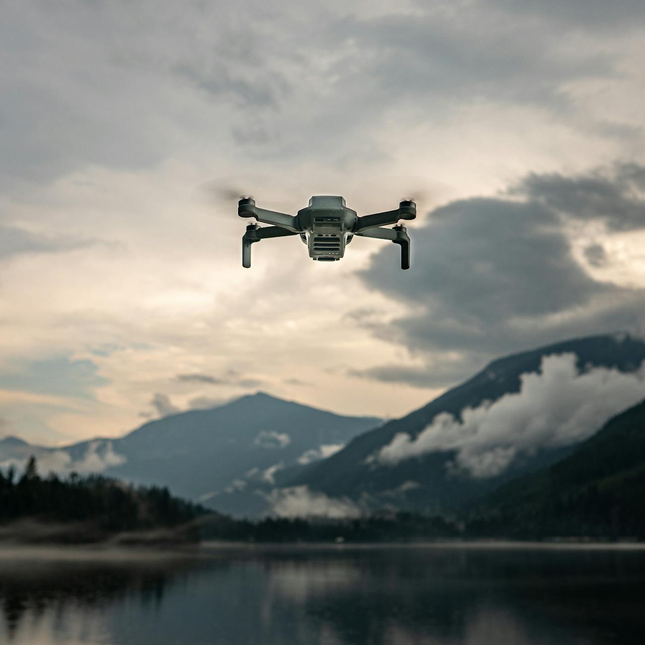
Unmanned Aerial Vehicle (UAV): An unmanned aerial vehicle (UAV), commonly known as a drone, is an aircraft without a human pilot onboard. UAVs can be remotely controlled or fly autonomously using pre-programmed flight paths or dynamic mission planning.
Remote Control: Remote control is a method of operating UAVs from a distance using radio frequency (RF) signals or other communication technologies. Pilots can control the drone's movement, altitude, and orientation through a handheld controller or a computer interface.
Autonomous Flight: Autonomous flight refers to the ability of a drone to operate independently without direct human intervention. UAVs can use onboard sensors, GPS, and artificial intelligence algorithms to navigate, avoid obstacles, and complete tasks without continuous input from a pilot.
Flight Controller: The flight controller is a critical component of a drone that manages its stability, navigation, and flight parameters. It processes sensor data, executes control algorithms, and adjusts the drone's motors to maintain stability and follow user commands.
Global Positioning System (GPS): The Global Positioning System (GPS) is a satellite-based navigation system that provides accurate location and timing information to UAVs. Drones use GPS data to determine their position, navigate to waypoints, and return to a designated home point.
Sensors: Sensors are electronic devices that detect and measure physical parameters such as altitude, speed, temperature, and orientation. Drones use sensors like accelerometers, gyroscopes, barometers, and cameras to gather data for navigation, obstacle avoidance, and payload delivery.
Camera Payload: Camera payload refers to the onboard camera systems mounted on drones to capture photos and videos during flight. Cameras are essential for aerial photography, videography, surveying, mapping, and inspection applications in various industries.
Communication Systems: Communication systems enable the exchange of data between the drone and the ground control station. They use radio frequency (RF), Wi-Fi, cellular, or satellite links to transmit telemetry, video feeds, commands, and mission data in real-time.
Ground Control Station (GCS): The ground control station (GCS) is a user interface that allows operators to monitor and control UAVs during flight missions. It provides real-time telemetry, video feeds, flight parameters, and mission planning tools for safe and efficient drone operations.
Flight Modes: Flight modes are predefined settings or configurations that determine how a drone behaves in flight. Common flight modes include manual mode (pilot controls all aspects), altitude hold (maintains a fixed altitude), and loiter mode (hover in place).
Obstacle Avoidance: Obstacle avoidance is a feature that enables drones to detect and avoid obstacles in their flight path. UAVs use sensors such as ultrasonic, LiDAR, or computer vision systems to detect objects and adjust their trajectory to prevent collisions.
Battery Technology: Battery technology is crucial for powering drones and determining their flight endurance and range. Lithium-ion batteries are commonly used in UAVs due to their high energy density, lightweight, and rechargeable properties.
Payload Capacity: Payload capacity refers to the maximum weight that a drone can carry in addition to its own weight. It includes cameras, sensors, actuators, and other equipment needed for specific applications such as aerial photography, delivery, or agriculture.
Waypoint Navigation: Waypoint navigation is a method of guiding drones along pre-defined GPS coordinates or waypoints. UAVs can follow a series of waypoints to navigate complex flight paths, execute survey missions, or reach specific destinations autonomously.
Geofencing: Geofencing is a virtual boundary or restricted area defined by GPS coordinates that limits the movement of drones within a designated airspace. It helps prevent UAVs from flying into prohibited zones, airports, or sensitive areas for safety and regulatory compliance.
Real-Time Kinematic (RTK): Real-Time Kinematic (RTK) is a satellite navigation technique that enhances the accuracy of GPS positioning for drones. RTK systems use correction data from ground stations to provide centimeter-level positioning for precise aerial surveys, mapping, and inspection tasks.
Collision Avoidance System: A collision avoidance system is a technology that helps drones detect and avoid collisions with other aircraft, obstacles, or environmental hazards. It uses sensors, algorithms, and onboard processing to assess risks, calculate safe paths, and prevent accidents.
Emergency Procedures: Emergency procedures are protocols and actions that drone operators follow in case of system failures, flight anomalies, or safety incidents. They include procedures for emergency landings, return-to-home (RTH), battery failures, and communication loss to mitigate risks and ensure safe operations.
Regulatory Compliance: Regulatory compliance refers to adhering to laws, rules, and guidelines set by aviation authorities and government agencies for safe and legal drone operations. Operators must comply with airspace regulations, pilot licensing, registration, and privacy laws to avoid fines or penalties.
Risk Assessment: Risk assessment is the process of identifying, evaluating, and mitigating potential risks associated with drone operations. It involves analyzing factors such as weather conditions, airspace congestion, equipment malfunctions, and human errors to enhance safety and decision-making.
Flight Planning: Flight planning involves designing and organizing drone missions based on operational requirements, objectives, and constraints. It includes route planning, airspace analysis, weather monitoring, payload selection, and contingency planning to ensure successful and efficient flights.
Weather Conditions: Weather conditions play a crucial role in drone operations and flight safety. Factors such as wind speed, temperature, humidity, visibility, and precipitation can impact UAV performance, flight endurance, and mission success. Pilots must consider weather forecasts and conditions before flying.
Challenges and Limitations: Drone technology faces various challenges and limitations that affect its widespread adoption and integration into different industries. These include regulatory restrictions, airspace management, security concerns, privacy issues, limited range, payload capacity, and battery life.
Applications: Drone technology has diverse applications across industries such as agriculture, construction, filmmaking, infrastructure inspection, search and rescue, surveillance, disaster response, and delivery services. UAVs are used for mapping, monitoring, data collection, imaging, and other tasks that benefit from aerial perspectives.
Future Trends: The future of drone technology is poised for significant advancements in areas such as artificial intelligence, automation, swarm intelligence, 5G connectivity, long-endurance flights, beyond visual line of sight (BVLOS) operations, urban air mobility, and integrated airspace management systems.
Professional Development: Professional development in drone technology involves acquiring knowledge, skills, certifications, and practical experience to become a competent drone pilot, operator, technician, or manager. Training programs, workshops, online courses, and hands-on practice are essential for career growth and specialization in the drone industry.
Industry Standards: Industry standards and best practices guide the design, manufacturing, operation, and maintenance of drones to ensure quality, safety, and interoperability. Organizations like the International Civil Aviation Organization (ICAO), Federal Aviation Administration (FAA), and European Aviation Safety Agency (EASA) set standards for UAVs and drone operations globally.
Integration with Other Technologies: Drones are increasingly integrated with other technologies such as artificial intelligence, Internet of Things (IoT), cloud computing, robotics, and sensors to enhance their capabilities and applications. This integration enables drones to perform complex tasks, collaborate with other systems, and provide valuable insights for decision-making.
Environmental Impact: The environmental impact of drone technology includes factors such as energy consumption, carbon emissions, noise pollution, wildlife disturbance, and land use. Sustainable practices, eco-friendly materials, efficient operations, and proper disposal of batteries are essential for minimizing the environmental footprint of drones.
Public Perception and Acceptance: Public perception and acceptance of drones are influenced by factors such as privacy concerns, security risks, noise disturbances, regulatory compliance, and ethical considerations. Building trust, transparency, and communication with the community are crucial for promoting the positive benefits of drones and addressing public concerns.
Innovation and Research: Innovation and research drive advancements in drone technology through new designs, algorithms, materials, sensors, and applications. Research institutions, universities, startups, and industry collaborations play a vital role in pushing the boundaries of UAV capabilities, performance, and safety standards.
Commercialization and Market Trends: The commercialization of drones has led to a growing market for UAVs, services, software, and accessories in various sectors. Market trends such as increased demand for drone delivery, aerial imaging, surveillance systems, inspection services, and agriculture applications shape the future growth and opportunities in the drone industry.
Conclusion: Drone technology fundamentals encompass a wide range of concepts, components, applications, and challenges that shape the evolving landscape of unmanned aerial vehicles. Understanding key terms and vocabulary in drone technology is essential for professionals in the drone industry, including pilots, operators, engineers, and managers. By mastering these fundamentals, individuals can enhance their knowledge, skills, and expertise to navigate the complexities of drone operations, regulations, and innovations in the dynamic field of aerial robotics.
Key takeaways
- Drone Technology: Drone technology refers to the hardware and software systems that enable the operation of unmanned aerial vehicles (UAVs) or drones.
- Unmanned Aerial Vehicle (UAV): An unmanned aerial vehicle (UAV), commonly known as a drone, is an aircraft without a human pilot onboard.
- Remote Control: Remote control is a method of operating UAVs from a distance using radio frequency (RF) signals or other communication technologies.
- UAVs can use onboard sensors, GPS, and artificial intelligence algorithms to navigate, avoid obstacles, and complete tasks without continuous input from a pilot.
- Flight Controller: The flight controller is a critical component of a drone that manages its stability, navigation, and flight parameters.
- Global Positioning System (GPS): The Global Positioning System (GPS) is a satellite-based navigation system that provides accurate location and timing information to UAVs.
- Drones use sensors like accelerometers, gyroscopes, barometers, and cameras to gather data for navigation, obstacle avoidance, and payload delivery.