Introduction to Drone Technology
Introduction to Drone Technology:
Introduction to Drone Technology:
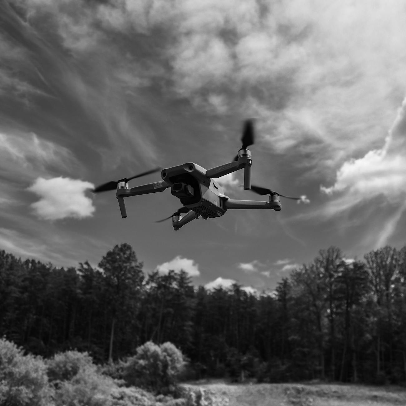
Drones, also known as unmanned aerial vehicles (UAVs), are aircraft that are operated without a human pilot on board. They can be controlled remotely by a pilot or autonomously by onboard computers. Drone technology has rapidly advanced in recent years, leading to a wide range of applications in various industries such as agriculture, construction, photography, and surveillance.
Key Terms and Vocabulary:
1. UAV: UAV stands for Unmanned Aerial Vehicle. It is a type of aircraft that does not require a human pilot on board to operate. UAVs are commonly referred to as drones and can be controlled remotely or autonomously.
2. Remote Control: Remote control is a method of controlling a drone from a distance. It involves using a handheld controller or a mobile device to send commands to the drone, such as adjusting its altitude, speed, and direction.
3. Autopilot: Autopilot is a feature of drone technology that allows the aircraft to fly autonomously without manual control from a pilot. Autopilot systems use sensors, GPS, and pre-programmed flight paths to navigate the drone.
4. Payload: Payload refers to the equipment or cargo that a drone carries during flight. This can include cameras for aerial photography, sensors for data collection, or packages for delivery.
5. FPV (First Person View): FPV is a method of flying a drone where the pilot uses a live video feed from an onboard camera to navigate the aircraft. This gives the pilot a first-person perspective of the flight, similar to being in the cockpit.
6. Altitude: Altitude refers to the height at which a drone is flying above the ground. Drones can fly at varying altitudes depending on the intended purpose of the flight, such as low altitude for aerial photography or high altitude for surveillance.
7. GPS (Global Positioning System): GPS is a satellite-based navigation system that provides location and time information to a GPS receiver on a drone. GPS is used for navigation, waypoint tracking, and return-to-home functions.
8. Waypoints: Waypoints are specific locations or coordinates that are programmed into a drone's flight path. By setting waypoints, a pilot can plan a route for the drone to follow automatically, allowing for precise navigation.
9. Hovering: Hovering is the ability of a drone to stay in one position in the air without moving horizontally or vertically. Drones use sensors and control algorithms to maintain stability and control during hovering.
10. Obstacle Avoidance: Obstacle avoidance is a feature of some drones that allows them to detect and navigate around obstacles in their flight path. This technology uses sensors, cameras, and algorithms to prevent collisions during flight.
11. Geofencing: Geofencing is a virtual boundary set for a drone using GPS technology. It restricts the drone from flying outside of a designated area, providing safety and security measures to prevent unauthorized flights.
12. Battery Life: Battery life refers to the amount of time a drone can fly on a single battery charge. The battery life of a drone determines the flight time and operational capabilities of the aircraft.
13. Flight Modes: Flight modes are pre-programmed settings on a drone that determine how the aircraft behaves in flight. Common flight modes include manual mode, altitude hold, GPS mode, and return-to-home.
14. Aerodynamics: Aerodynamics is the study of how air flows around objects, such as aircraft. Understanding aerodynamics is essential for designing and operating drones efficiently and safely.
15. Propulsion System: The propulsion system of a drone refers to the motors and propellers that generate thrust to lift and propel the aircraft. Different types of propulsion systems, such as electric motors or gas engines, are used in drones.
16. Remote Sensing: Remote sensing is the process of collecting data from a distance using sensors onboard a drone. Drones equipped with remote sensing technology can capture images, videos, and other data for various applications.
17. Photogrammetry: Photogrammetry is a technique used in drone technology to create 3D models and maps from aerial photographs. By capturing overlapping images of a terrain, photogrammetry software can reconstruct the landscape in 3D.
18. LiDAR (Light Detection and Ranging): LiDAR is a remote sensing technology that uses laser pulses to measure distances to objects on the ground. Drones equipped with LiDAR sensors can create detailed topographic maps and 3D models of the terrain.
19. Thermal Imaging: Thermal imaging is a technology that allows drones to capture infrared radiation emitted by objects. Thermal cameras onboard drones can detect heat signatures and temperature variations, useful for applications like search and rescue or building inspections.
20. Regulations: Regulations refer to rules and laws governing the operation of drones in a specific region. Drone regulations may include restrictions on flight altitude, flight zones, registration requirements, and safety guidelines to ensure responsible drone operations.
21. Line of Sight: Line of sight is the distance within which a drone pilot must maintain visual contact with the aircraft during flight. Regulations in many countries require drones to be flown within the pilot's line of sight for safety and control purposes.
22. BVLOS (Beyond Visual Line of Sight): BVLOS refers to drone operations that are conducted beyond the pilot's visual line of sight. BVLOS flights require special permissions and technologies, such as remote ID systems and detect-and-avoid capabilities, to ensure safety and compliance with regulations.
23. Remote ID: Remote ID is a technology that allows authorities to identify and track drones in real-time during flight. Remote ID systems transmit the drone's location, altitude, and registration information to ensure accountability and safety in shared airspace.
24. Counter-Drone Technology: Counter-drone technology includes measures to detect, track, and mitigate unauthorized drones flying in restricted areas. Counter-drone systems use sensors, jammers, and other technologies to protect critical infrastructure and prevent security threats.
25. Data Security: Data security refers to the protection of sensitive information collected by drones during flight. Ensuring data security involves encrypting data transmissions, securing storage devices, and implementing cybersecurity measures to prevent unauthorized access or data breaches.
26. Remote Piloting: Remote piloting is the practice of controlling a drone from a remote location, such as a ground control station. Remote pilots use radio communication or wireless technologies to send commands to the drone and monitor its flight status.
27. Emergency Procedures: Emergency procedures are protocols and actions to be followed in the event of a drone malfunction or unexpected situation during flight. Pilots should be trained to handle emergencies, such as loss of control, signal interference, or battery failure, to ensure safe operations.
28. Maintenance and Inspections: Maintenance and inspections are essential tasks to keep drones in optimal condition and ensure safe and reliable operations. Regular maintenance checks, software updates, and visual inspections help prevent malfunctions and prolong the lifespan of the aircraft.
29. Flight Training: Flight training is the process of learning how to operate a drone safely and effectively. Training programs cover topics such as flight controls, regulations, emergency procedures, and flight maneuvers to equip pilots with the skills needed to fly drones.
30. Environmental Impact: The environmental impact of drones refers to the effects of drone operations on ecosystems, wildlife, and air quality. Sustainable drone practices, such as minimizing noise pollution, reducing carbon emissions, and avoiding sensitive habitats, can help mitigate environmental impacts.
Conclusion:
In conclusion, understanding the key terms and vocabulary related to drone technology is essential for aspiring drone engineers and operators. By familiarizing themselves with concepts such as UAVs, autopilot, payload, and remote sensing, students can gain a comprehensive understanding of drone technology and its diverse applications. Mastering the terminology and principles of drone technology equips learners with the knowledge and skills needed to navigate the rapidly evolving field of drones and contribute to innovative solutions in various industries.
Key takeaways
- Drone technology has rapidly advanced in recent years, leading to a wide range of applications in various industries such as agriculture, construction, photography, and surveillance.
- UAVs are commonly referred to as drones and can be controlled remotely or autonomously.
- It involves using a handheld controller or a mobile device to send commands to the drone, such as adjusting its altitude, speed, and direction.
- Autopilot: Autopilot is a feature of drone technology that allows the aircraft to fly autonomously without manual control from a pilot.
- This can include cameras for aerial photography, sensors for data collection, or packages for delivery.
- FPV (First Person View): FPV is a method of flying a drone where the pilot uses a live video feed from an onboard camera to navigate the aircraft.
- Drones can fly at varying altitudes depending on the intended purpose of the flight, such as low altitude for aerial photography or high altitude for surveillance.